| Olive Through the Ages
Historical
descriptions | Maps and photos | Olive
boundaries
_____________________________________________________________________________
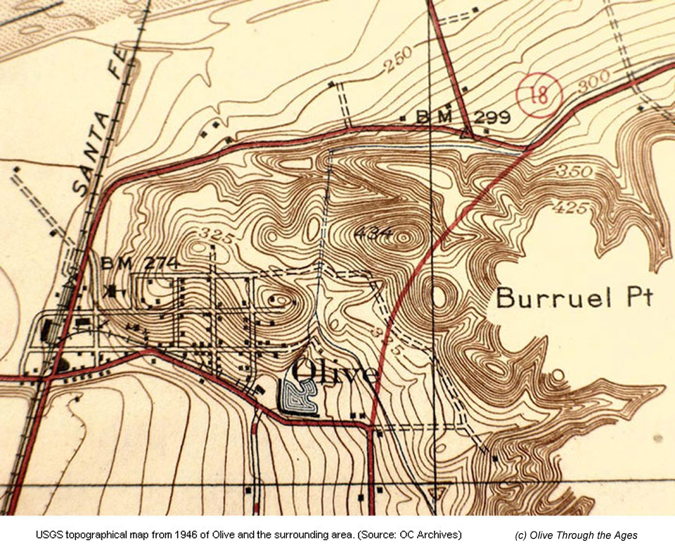
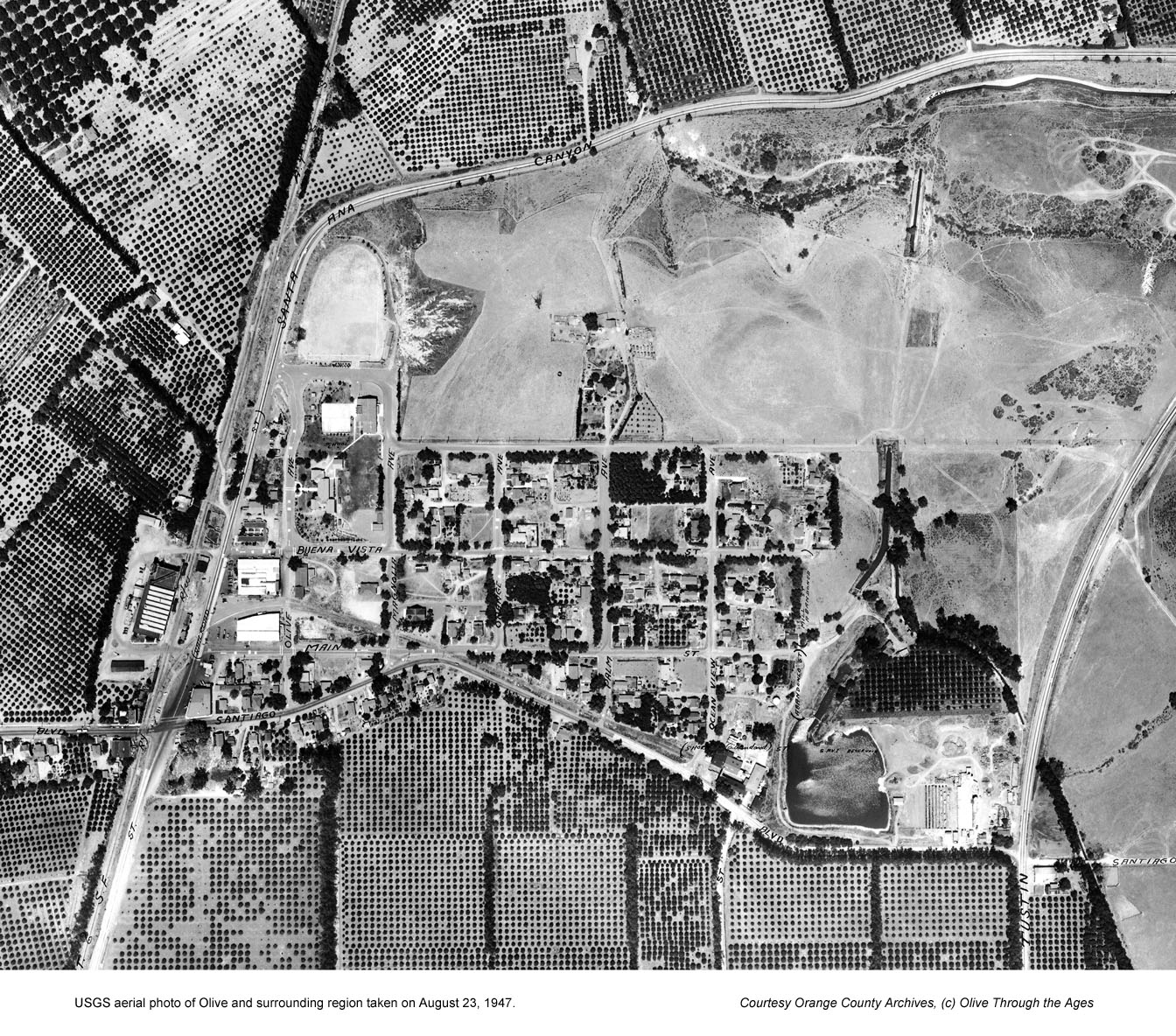
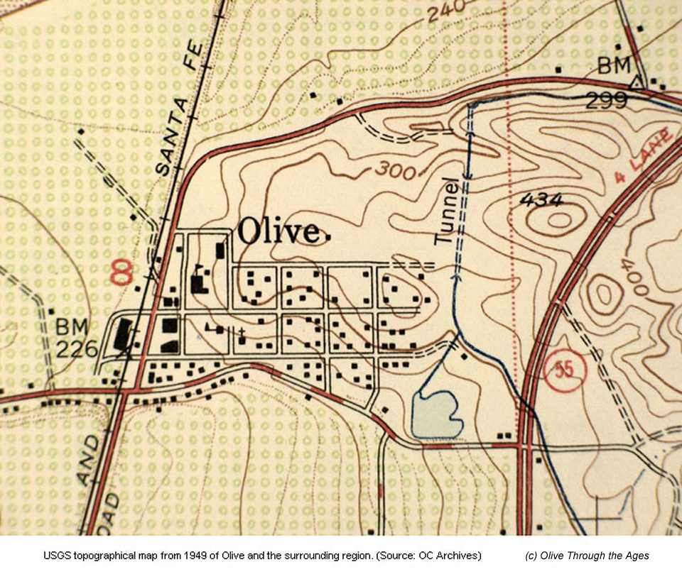
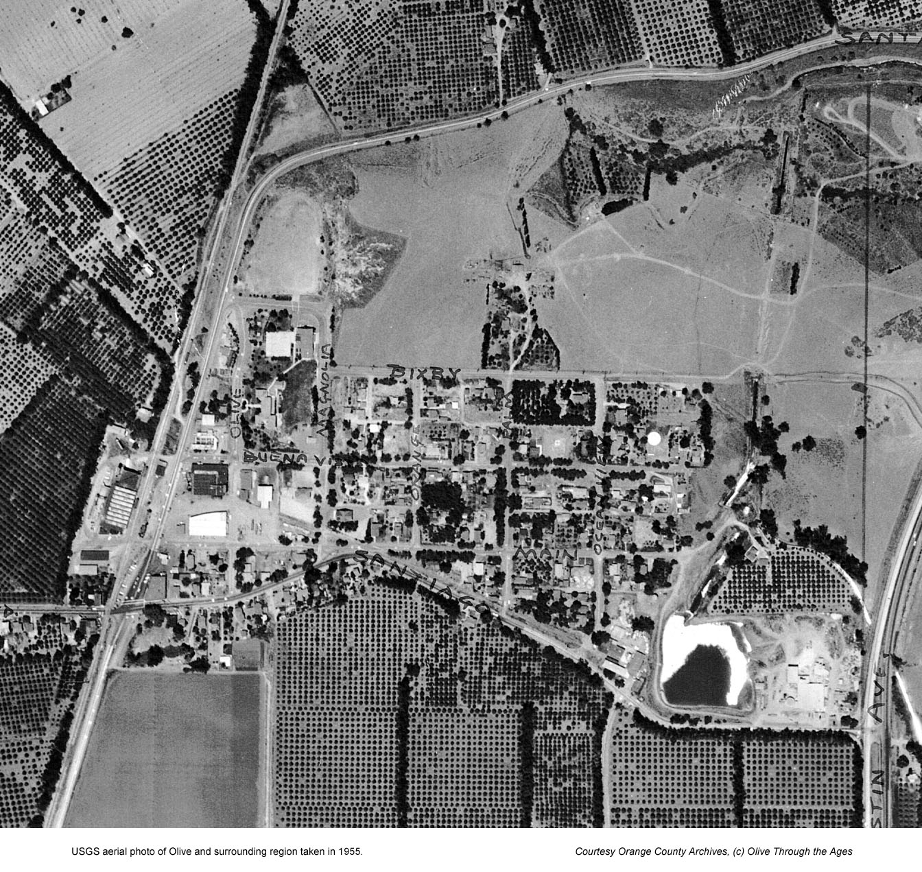
Historical maps and aerial photos
This collection of images includes copies
of historical, illustrated, topographical, and aerial photo maps of
the Olive community and its surrounding region. Click/tap a thumbnail to
view the larger, complete image in a separate browser window/tab.

Historical area maps and images
When reading descriptions of Olive from the
1890s up until the early 1900s, it helps to know where Olive is located
in relation to other towns, some that no longer exist. For this purpose,
maps of Orange County from 1901 and 1928 are provided via links in the
section below.
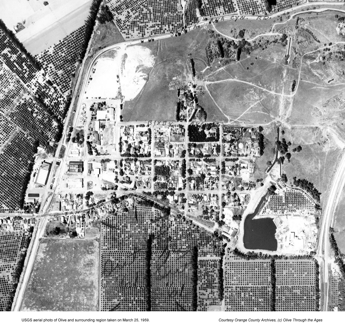
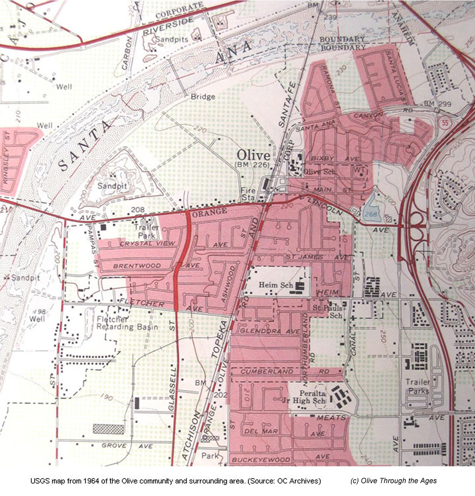
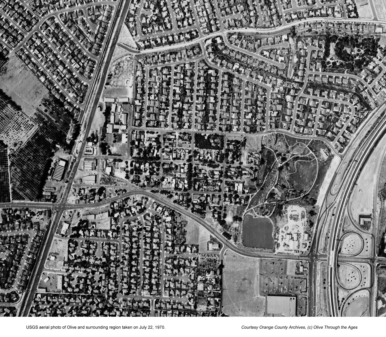
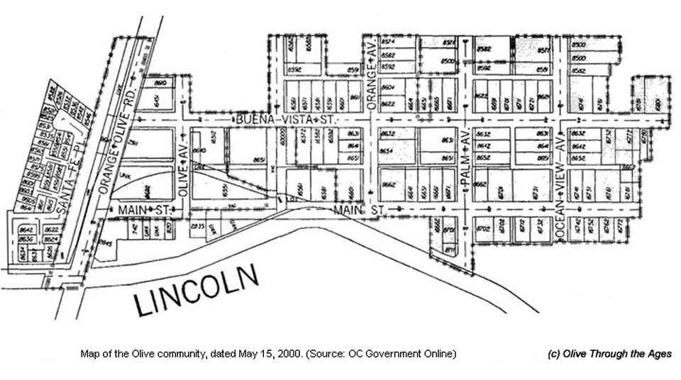
It is interesting to see how much the Olive area has changed over the
past 110 years by looking at the collection of images linked to this
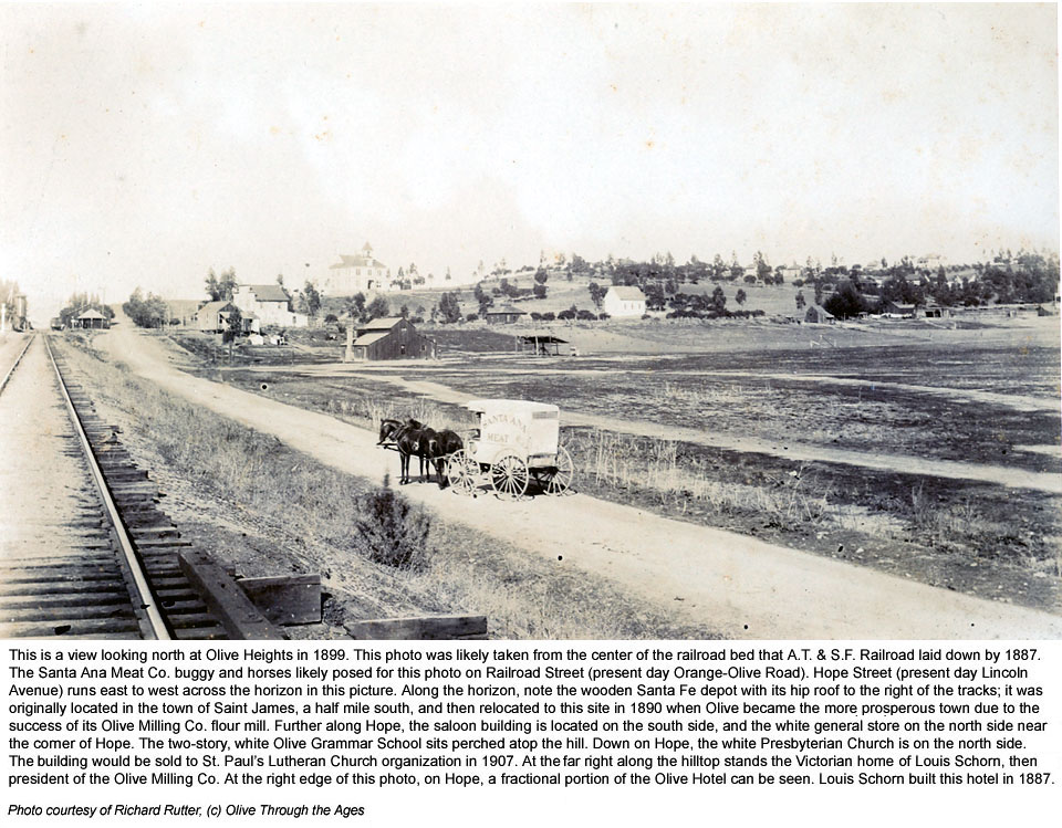
page. The photo from 1899 shows a horse-drawn meat wagon on a dusty,
narrow road that would one day become the well-traveled, Orange-Olive
Road. The undeveloped land that had not yet revealed its potential as
a citrus haven would later be filled with groves, and eventually shops
and housing tracts in modern times.
Thanks to Chris Jepsen at the Orange County Archives, Anaheim Heritage
Center Disney Resort Reading Room, Orange Public Library History Center,
Richard Rutter, and Mike Paulus for providing these images. Click/tap the
thumbnail images below to view larger images in a separate browser window
or tab:
| Historical
area maps: Orange County and Olive Road District |

|
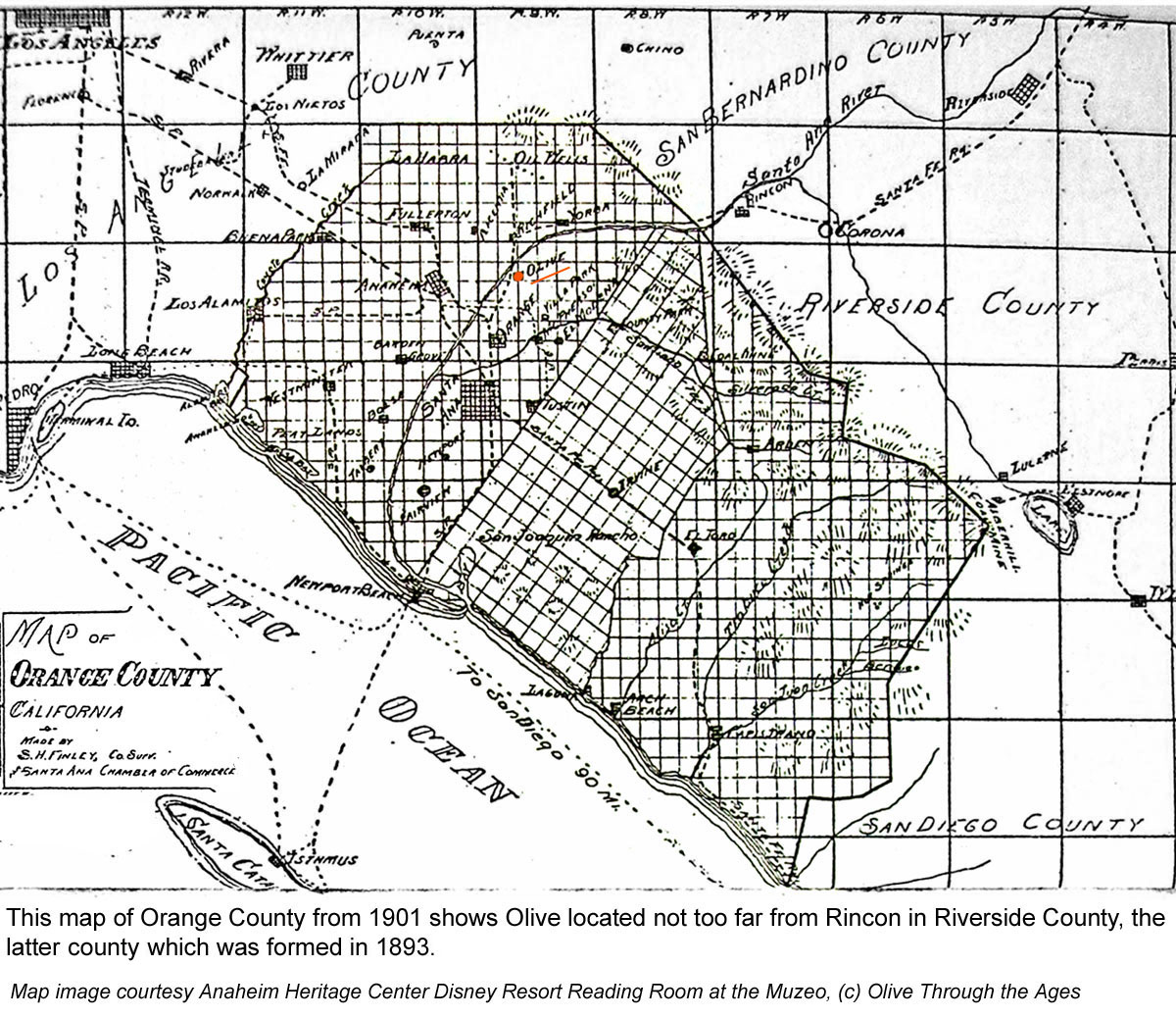
Orange County map from 1901. (Source: Anaheim Heritage Center Disney
Resort Reading Room)
|
|

|
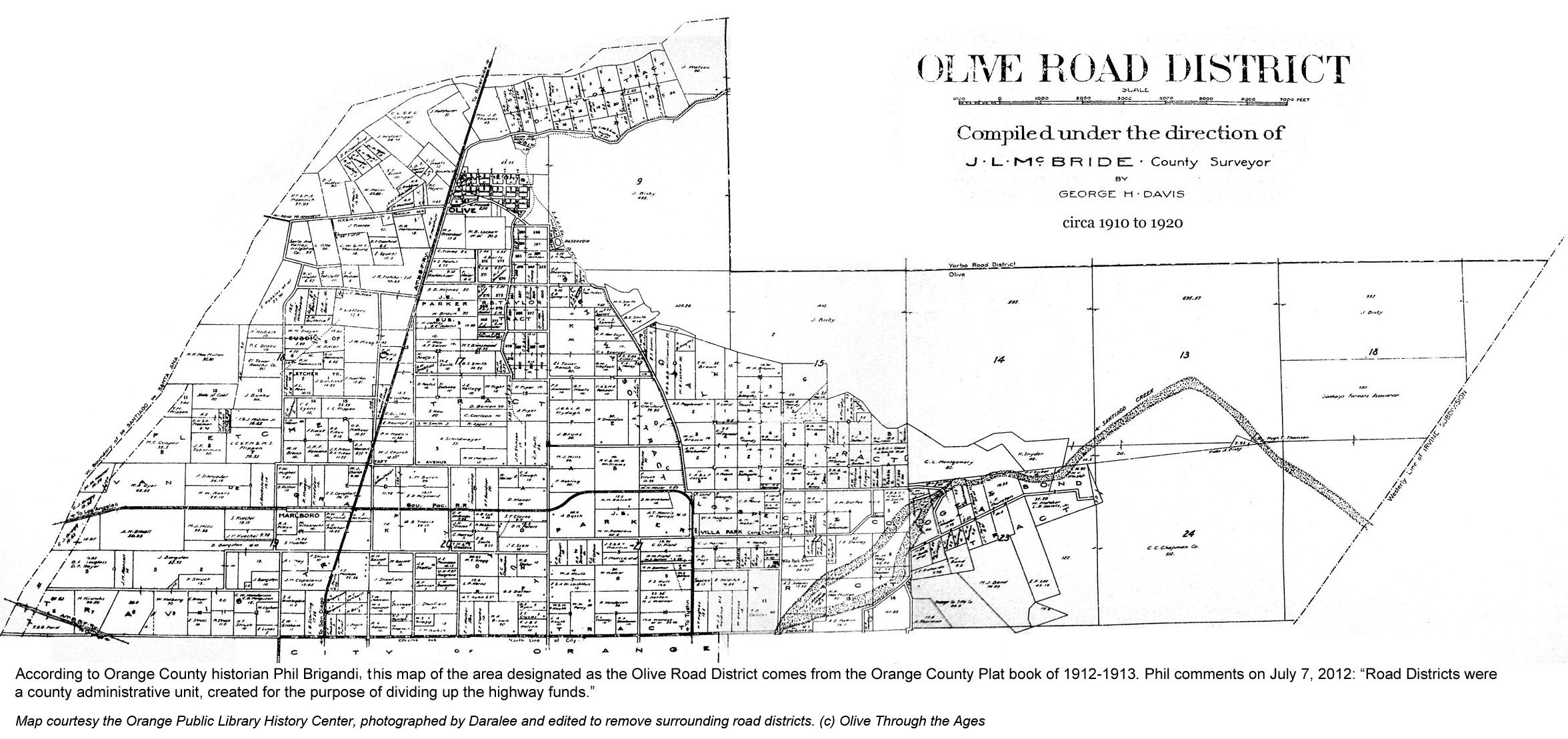
Olive Road District map, circa 1912 to 1913. (Source: Orange Public
Library History Center) |
| |
|
|
|
|
 |
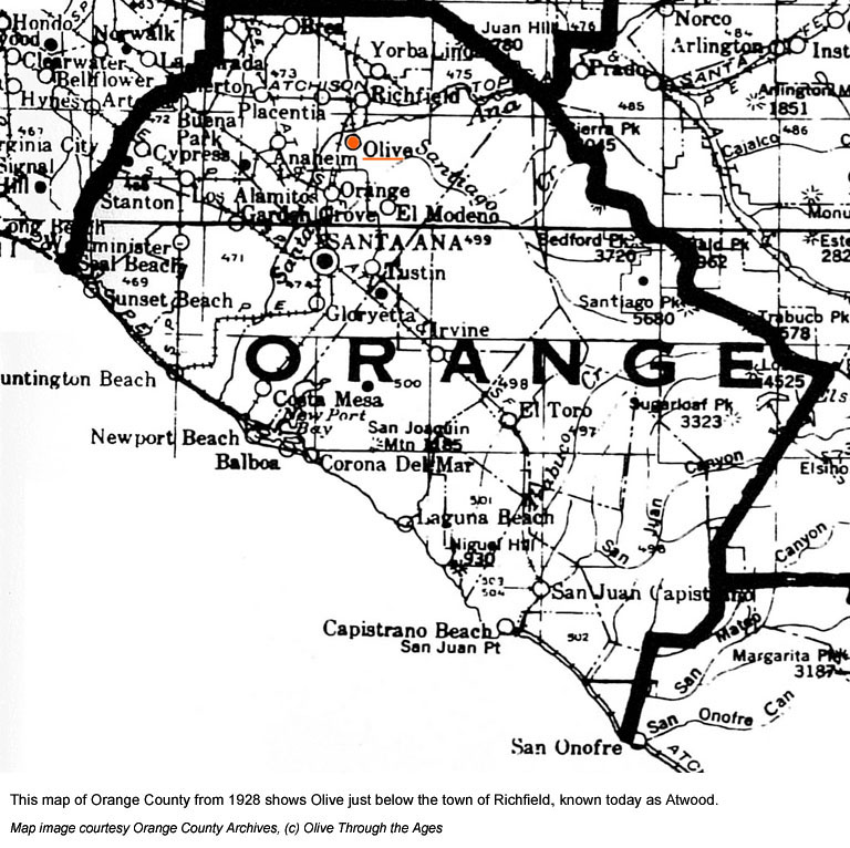
Orange County
map from 1928. (Source: Orange County Archives) |
|
|
|
| |
|
|
|
|
| Historical images of Olive:
Then and now |

|
View looking north up Railroad St. (Orange-Olive Road) towards Hope
Street (Lincoln Avenue) in 1899. |
|

|
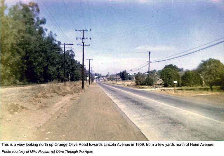
View north looking up Orange-Olive Road towards Lincoln Avenue in
1959. |
| |
|
|
|
|
 |
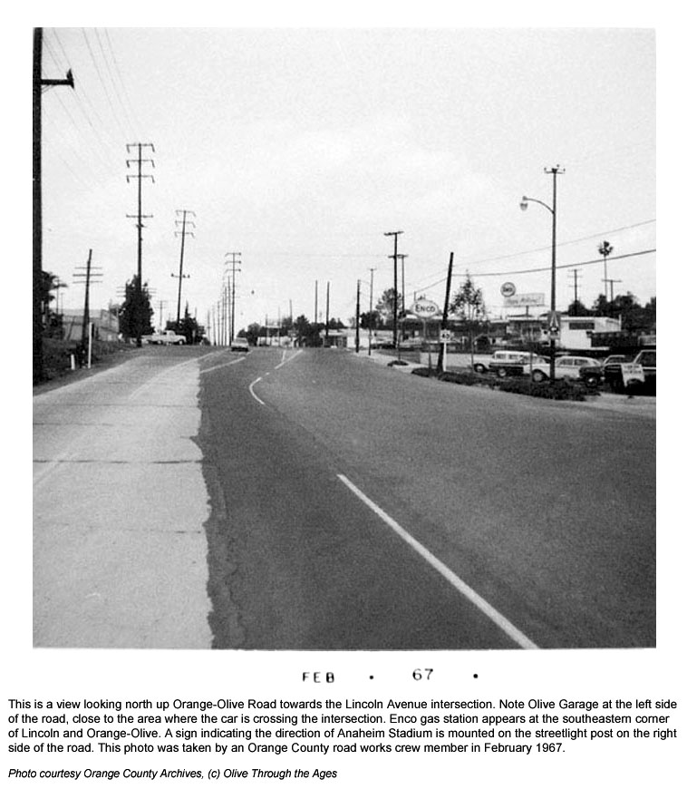
View looking
north up Orange-Olive Road towards Lincoln Avenue in February 1967. |
|
 |
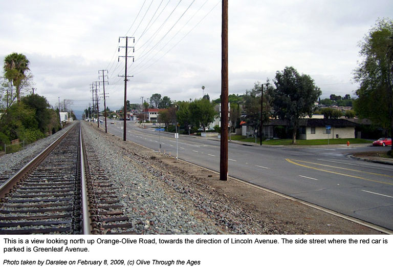
View
looking north up Orange-Olive Road towards Lincoln Avenue in 2009. |
| |
|
|
|
|
 |
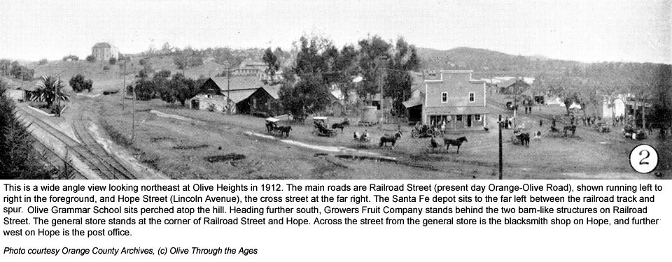
Panoramic view
of Olive in 1912 with the wooden general store at Railroad St. (Orange-Olive
Rd.) and Hope St. (Lincoln Ave.)
|
|

|
View of Olive
circa 1918 with the wooden general store and gas station on Railroad
St. (Orange-Olive Rd.) |
| |
|
|
|
|
 |
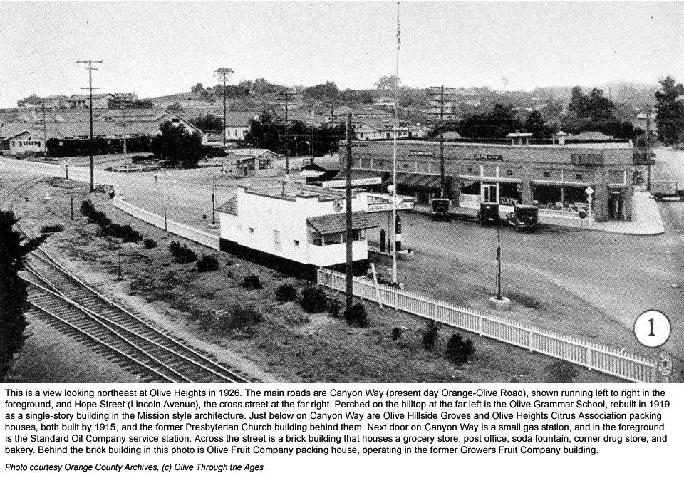
Panoramic view
of Olive in 1926 with a brick building replacing the wooden general
store on Railroad St. (Orange-Olive Rd.) |
|
 |
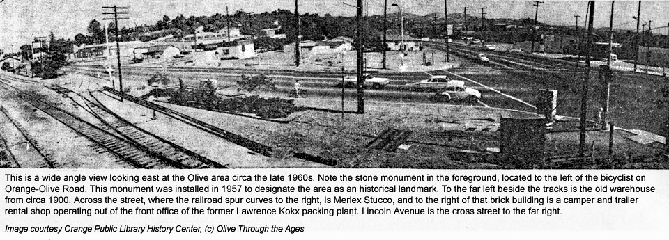
Panoramic view
of Orange-Olive Road looking towards Olive Heights circa the late
1960s. |
| |
|
|
|
|
 |
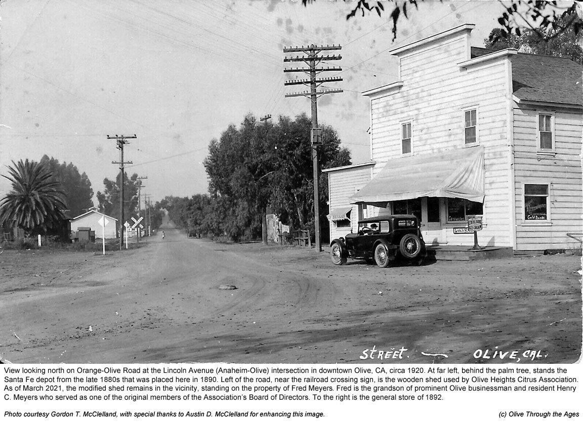
View of downtown
Olive circa 1920 with the wooden general store on Orange-Olive Road. |
|
 |
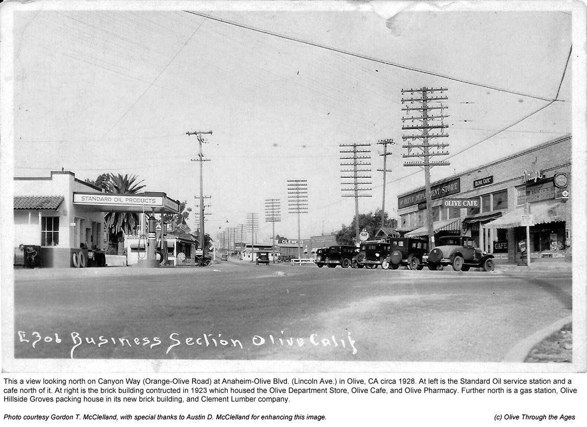
View
of downtown Olive circa 1928 with the brick building on Orange-Olive
Road and brick Olive Hillside Groves (Merlex Stucco) building. |
| |
|
|
|
|
 |
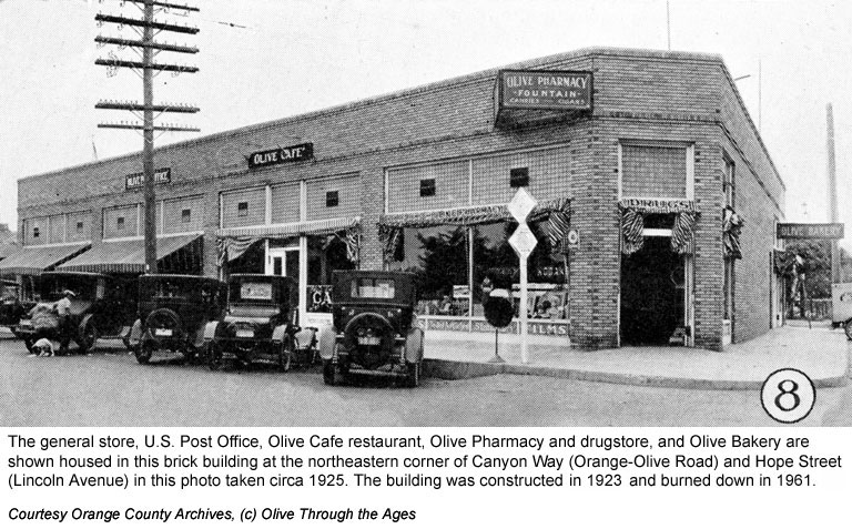
View of the
brick building on Orange-Olive Road at Lincoln circa 1925. |
|
 |
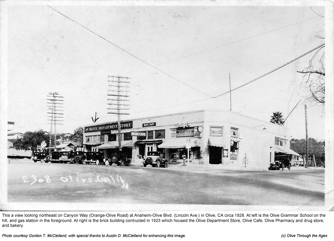
View of the
brick building on Orange-Olive Road at Lincoln circa 1928. |
| |
|
|
|
|
 |
View
of the brick building on Orange-Olive Road at Lincoln in 1951. |
|
 |
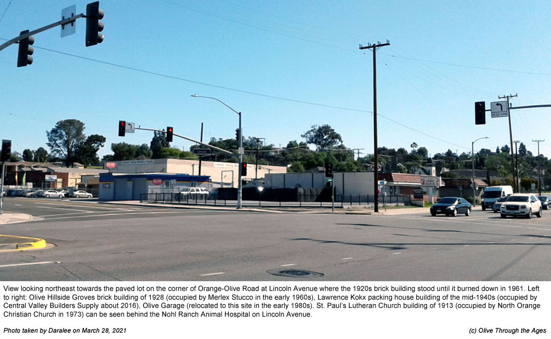
View
of Orange-Olive Road at Lincoln Ave. intersection in March 2021. |
| |
|
|
|
|
|