| Olive Through the Ages
Taming
the river | Maps and images
_____________________________________________________________________________
The maps and images accessible via links from this page
accompany the story about the taming of the Santa Ana River at Olive.
My thanks to Chris Jepsen and Susan Berumen of the Orange County Archives
for providing many of these images, as well as the video footage showing
the 1938 flood of at Olive. Additionally, I would like to thank Susan
Pelis (a descendant of the Watson family) for informing me that a portion
of the S.A.V.I. Co. canal still exists in the Santa Ana Canyon, and
for identifying the location of that site. - Daralee

Click/tap the thumbnail images below to view
larger images in a separate browser window or tab:
| River crossing
point |
 |
This recent photo suggests the point where historical figures crossed
the river at Olive, close to present day Glassell Street bridge. |
|

|
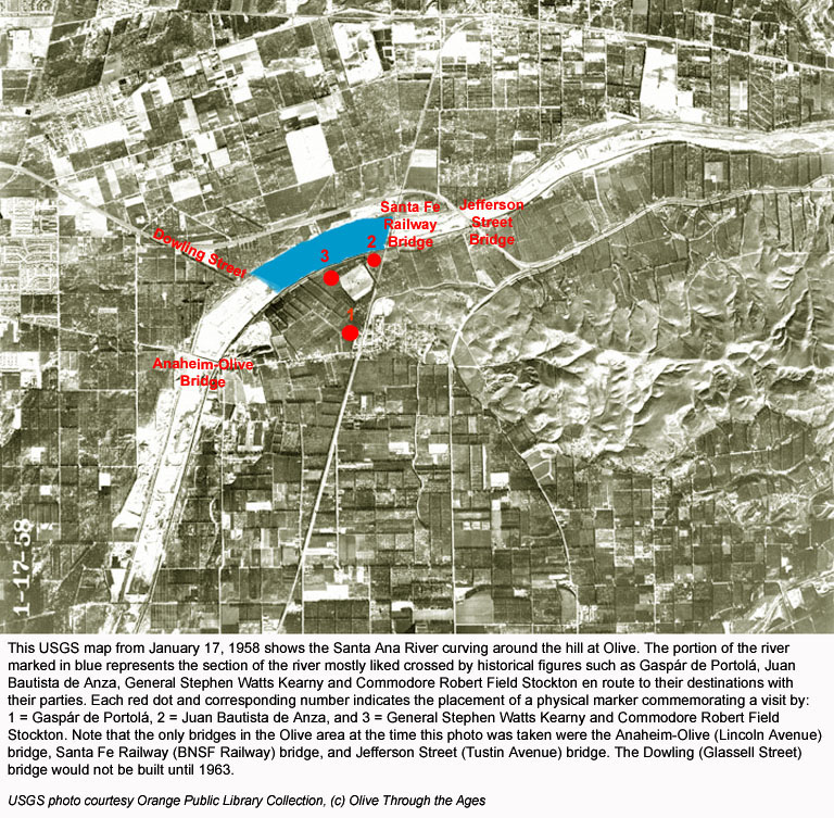
This map suggests the river crossing site for: Gaspár
de Portolá, Juan
Bautista de Anza, and Stephen
Watts Kearny and Robert Field Stockton. |
| |
|
|
|
|
| Irrigation
in Olive |

|
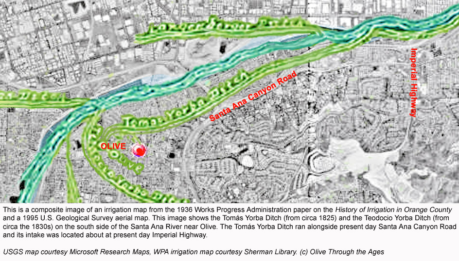
This composite image shows the location of the irrigation ditches
made by Tomás Yorba and Teodocio Yorba. (Source: SL)
|
|

|
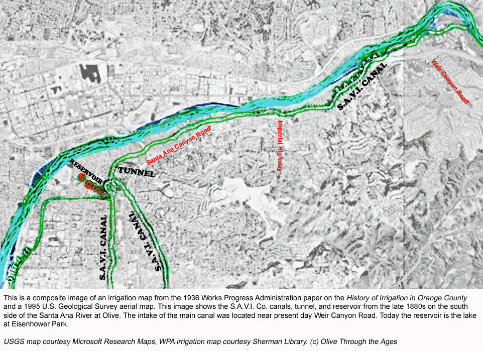
This composite image shows the location of the S.A.V.I. Co. irrigation
canals, tunnel, and reservoir. (Source: SL) |
| |
|
|
|
|
| S.A.V.I. Company canal and
tunnel |

|
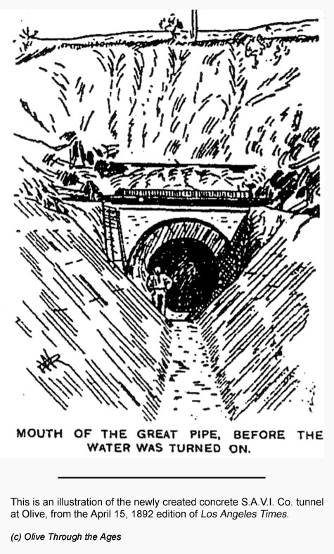
This illustration of the S.A.V.I. Co. tunnel and canal appeared
in an 1892 edition of Los Angeles Times. |
|

|
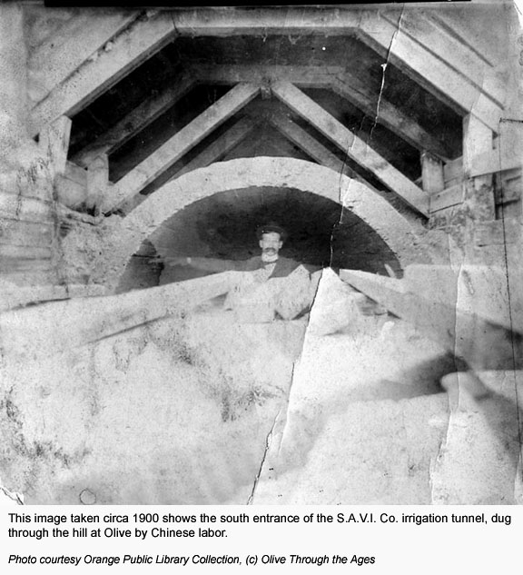
This photo shows the mouth of the S.A.V.I. Co. tunnel circa 1900.
(Source: OPL) |
| |
|
|
|
|
 |
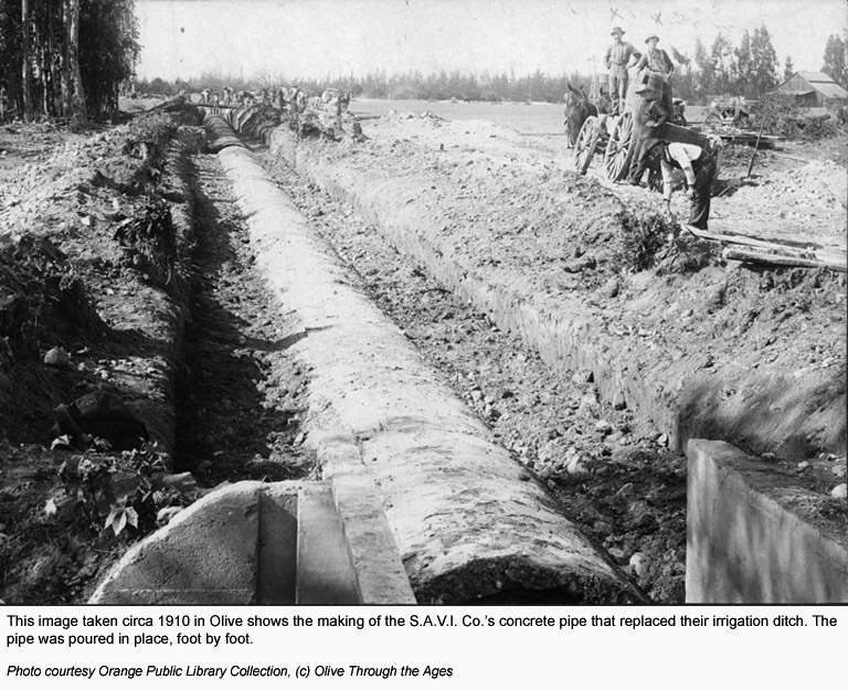
This photo
shows the construction of the concrete S.A.V.I. Co. pipe circa 1910.
(Source: OPL) |
|
 |
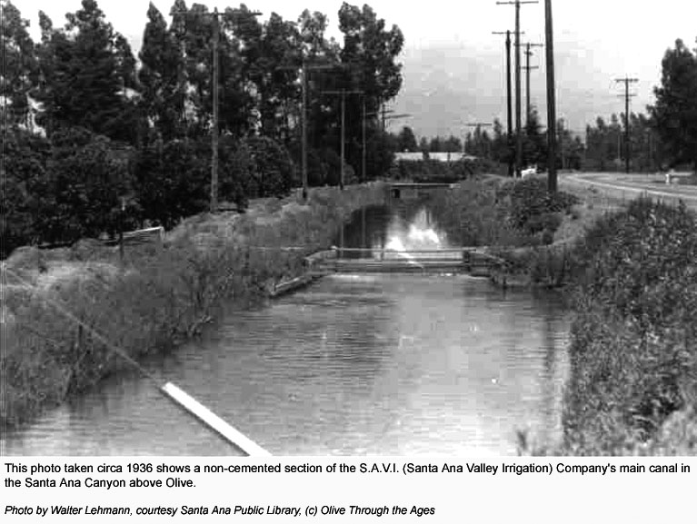
This photo
shows the open S.A.V.I. Co. canal north of Olive circa 1936. (Source:
OPL) |
| |
|
|
|
|
 |
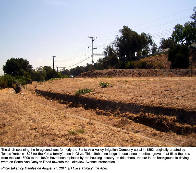
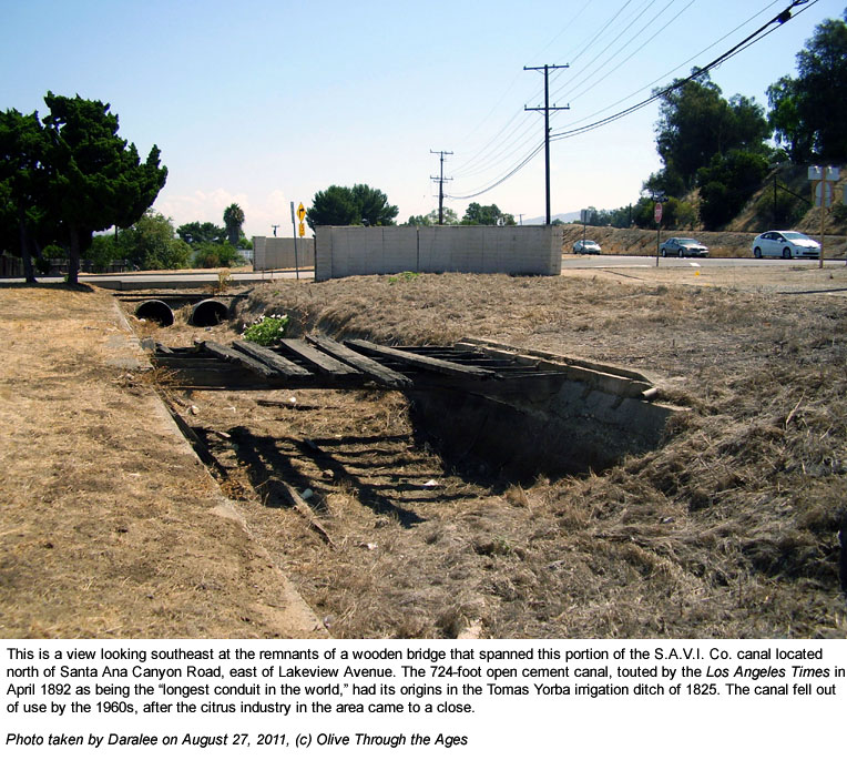
Susan Pelis,
a descendant of the Watsons, informed me that this portion of the
S.A.V.I. Co. canal still exists by Santa Ana Canyon Road. |
|
 |
Susan Pelis
clued me in on this old, battered, wooden bridge that spanned the
S.A.V.I. Co. canal just east of Lakeview Avenue. |
| |
|
|
|
|
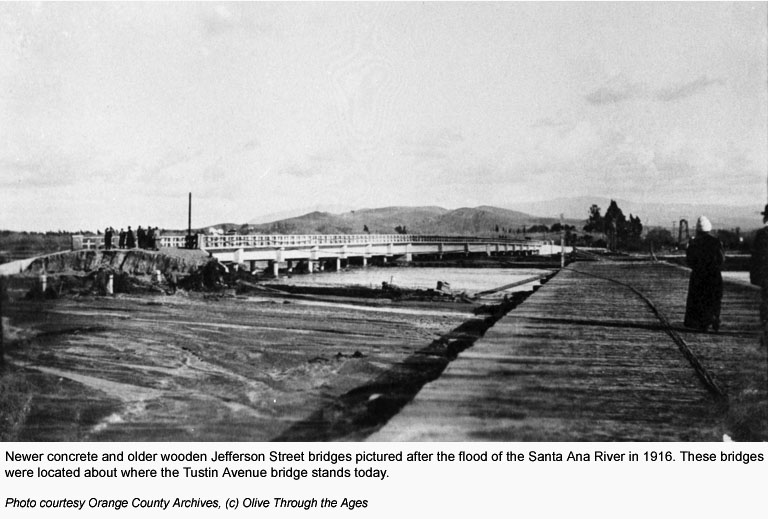
| Bridges then and now |

|
This image shows the new and old Jefferson St. (Tustin Avenue) bridges
after the 1916 flood. (Source: OC Archives) |
|

|
This photo shows the Tustin Avenue bridge in 2010. |
| |
|
|
|
|
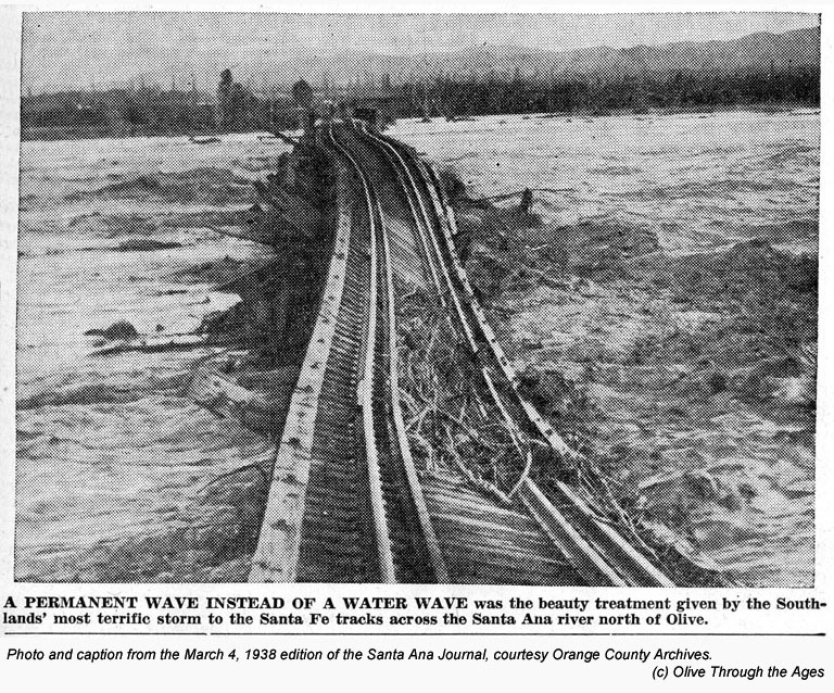
 |
This image
shows the Santa Fe Railway bridge in 1938 during the flood. (Source:
OC Archives) |
|
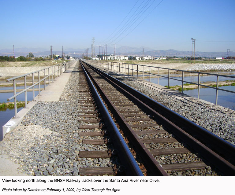
 |
This
photo shows the BNSF Railway bridge in 2009. |
| |
|
|
|
|
 |
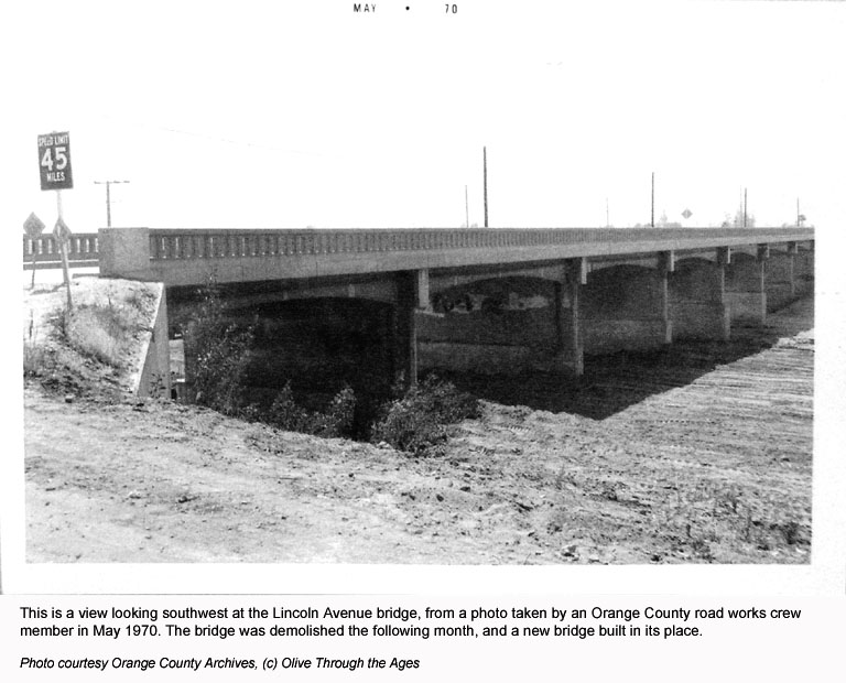
This image
shows the Lincoln Avenue bridge in May 1970 before it was demolished
in June. (Source: OC Archives)
|
|

|
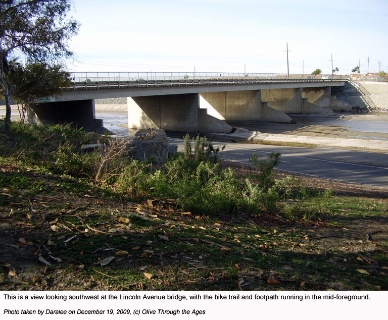
This image
shows the Lincoln Avenue bridge in 2009. |
| |
|
|
|
|
| Santa Ana Canyon river view |
 |
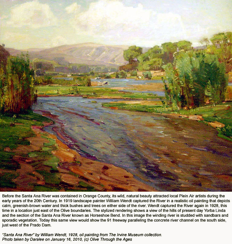
This painting by William Wendt shows the Santa Ana River in the
Santa Ana Canyon in 1938. |
|
 |
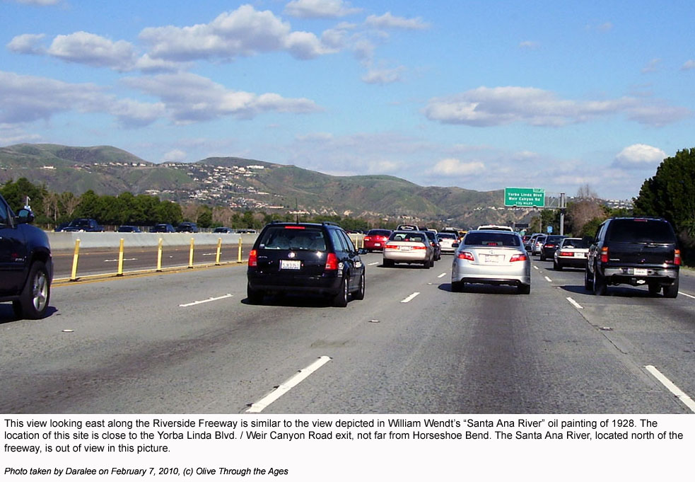
This 2010 photo shows a similar view of the Santa Ana Canyon depicted
in Wendt's painting. |
| |
|
|
|
|
 |
This 1997 photo
shows the Santa Ana River where it exits the Santa Ana Canyon and
bends south. (Source: OPL) |
|
|
|
| |
|
|
|
|
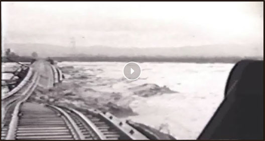
March 2, 1938 flood at Olive
-
historical video footage courtesy Orange County Archives |
|
View the OC Archives Flickr video by clicking/tapping the image
below.
|
|