Olive Through the Ages

Brick yard and tile company: Historic aerial maps

Brick yard & tile co. | Bank of Olive | Olive Garage | Olive Hotel & Motel | Olive
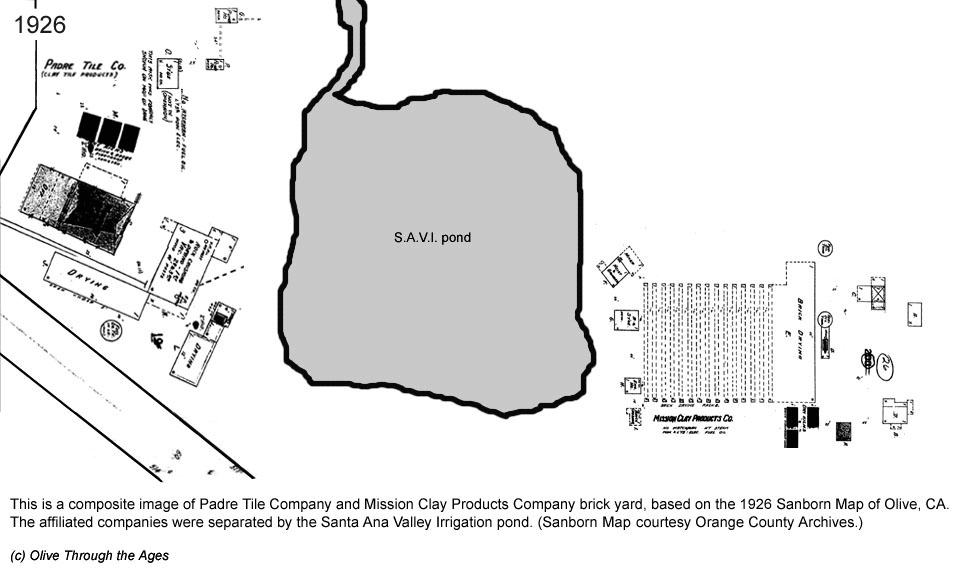
 Mill | Other
_____________________________________________________________________________

This page contains links to aerial map images of the Padre Tile Company and Mission Clay Products Company brick yard sites from 1926 to 1970, including commentary.


Click/tap the animated icon at right to to launch a separate browser window or tab containing a slideshow video (less than two minutes in length) of the aerial map images provided at the links in the section below.

NOTE: In order to view this video, you must have Adobe Flash Player or an equivalent Web player installed on your machine.


Click/tap the link below to view each image in a separate browser window or tab:

  1. 1929 Sanborn Map - Part 1 6. 1955 U.S.G.S. aerial map - Part 2
  2. 1929 Sanborn Map - Part 2 7. 1959 U.S.G.S. aerial map - Part 1
  3. 1938 U.S. Geological Survey aerial map 8. 1959 U.S.G.S. aerial map - Part 2
  4. 1947 U.S. Geological Survey aerial map 9. 1970 U.S.G.S. aerial map - Part 1
  5. 1955 U.S.G.S. aerial map - Part 1 10. 1970 U.S.G.S. aerial map - Part 2


Brick yard & tile co.


Go to Main menu