|
Brief history about Olive: 1956-present BC - 1869 | 1870
- 1899 | 1900
- 1955 | 1956 - PRESENT
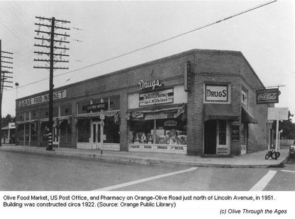
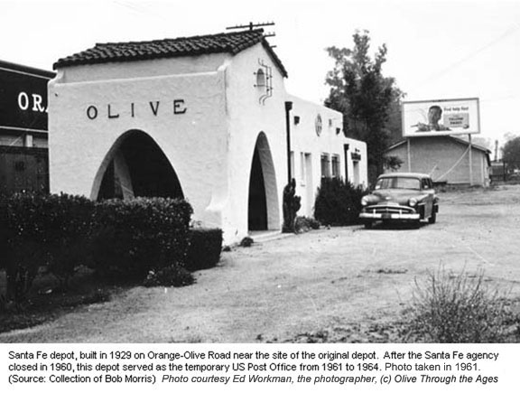
Orange County was becoming a suburban area. Orchard owners—or their descendants—began selling their property to housing developers in the 1950s, and the citrus groves disappeared one by one, replaced by tract homes. In 1958, Lawrence Kokx packing house ceased its operations (source: Tom Pulley) followed by Olive Hillside Groves in 1960,25 and the Santa Fe Railway agency at Olive also closed (see 1961 photo).39 The S.A.V.I. canal/tunnel—once heavily used by the flour mill and groves—was no longer used for irrigating the land and became surrounded by houses northeast of the original 1887 Olive Heights tract. In 1961, fire gutted the one-story brick building that housed The Olive Food Market, U.S. Post Office, and The Olive Pharmacy at the northeastern corner of Orange-Olive Road at Lincoln Avenue (see 1951 photo). The structure was never rebuilt,2 and in the interim the recently-retired Santa Fe Railway depot served as the temporary post office for the community.39 Meanwhile, the former Olive Hillside Groves building became occupied by a new tenant on January 11, 1963 (see 1969 photo). Merlex Stucco operated in that brick structure (see 2005 photo)24 until the company was acquired by Parex USA in 2016.
In July 1963, St. Paul's Lutheran Church and School relocated from Olive Heights to the southwestern corner of Heim and Canal (see 2006 photo).59 During the mid-1960s the Olive area underwent heavy road construction. On October 5, 1964 the former Santa Fe Railway depot structure was razed39 due to the realignment of Orange-Olive Road and Lincoln Avenue,9 and the U.S. Post Office relocated to the new Orange Olive Center, where the post office became known as the Olive Station (see 2004 photo).52 In 1966, the First National Bank of Olive building was razed due to the realignment of Lincoln Avenue,9 and the year after that, 400 feet of the Santa Fe spur line that led to the second flour mill was retired.18
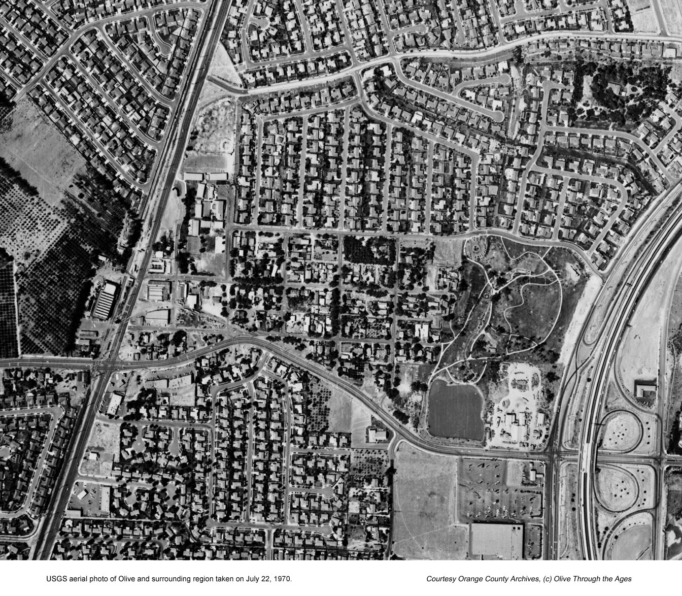
By the end of the 1960s and in the early 1970s, the Olive community and surrounding area had significantly evolved from a rural landscape to a suburban landscape. To accommodate the growing number of residents, more shopping centers were constructed. In addition to the Orange Olive Center on Orange-Olive Road, the Olive Heights Center strip mall had been operating on Lincoln Avenue for several years now (see 2005 photo). When Mission Clay Products Company brick yard moved to another city, The Brickyard shopping center opened in the 1970s at its former site on the corner of Lincoln and Tustin Avenue (see 2004 photo).24 All three shopping centers still exist today. To the immediate west of The Brickyard, Eisenhower Park was founded in 1969, encompassing the location of the original flour mill (see 2004 photo). The irrigation pond that had been fed by the S.A.V.I. canal became the park's lake. As the population in Orange County continued to grow throughout the 1970s, more housing tracts and shopping centers sprang up across the Southland.
Despite the amount of construction and activity in the Southland, the pace of life in the Olive community began slowing down during the 1980s. In 1983 the historic Olive Garage building became occupied in by C.C.c.c. Heating & Air Conditioning—its current tenant (see 2004 photo)—after the Olive Garage business moved to its current location on Orange-Olive Road (see 2005 photo).24 Due to declining enrollment and budget cuts, Olive Elementary School closed its doors after the school year ended in June 1984.31 Olive Heights Citrus Association (see 1982 photo) also shut down its operations following its merger with Orange Heights Citrus Association in Corona.33 The Association's property was purchased by a residential real estate developer in 1987, and in December 1988 fire gutted the interior of the vacant packing house.9 The building remained standing until 1997 when that structure and the historic Fire Station #20 (see 1982 photo)—which was deactivated in 1996 and closed on February 23, 199730—were both razed to make room for Greystone Crossing tract, constructed in 1998.34 Olive Elementary School experienced a renaissance when its doors reopened on September 7, 1999,16 after having been closed for 15 years. The school remains an active part of the Orange Unified School District today (see 2004 photo).
In recent times, Olive has become a residential island with long time residents struggling to maintain the community's identity and continue to keep their quiet lifestyle their own, apart from the encroachment of the City of Orange that surrounds it. Time will one day tell the story of what today lies in the future of the Olive community. But for now, the tale of how Olive came to be—through the heights and depths of a 200 year period—will remain a part of its own unique history forever.
__________________________________________ |
||||||||||||||||||||||||||
| Copyright © 2005 - Daralee's Web World. All rights reserved. | ||||||||||||||||||||||||||