| Olive
Through the Ages
Click/tap the map below to view it slightly larger. Click/tap
the link (A-K) to go to that section: Main,
A,
C, D,
E, F,
G, H,
I, J,
K
Click/tap B
to return to that section.
_____________________________________________________________________________

|  Ramón
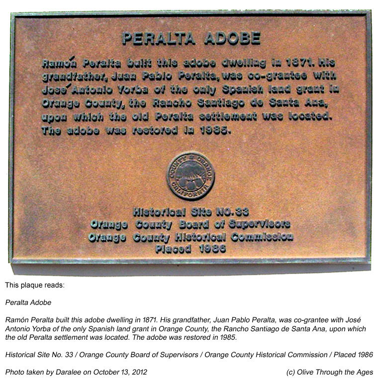
Peralta Adobe: The plaque mounted on the wall outside the
Ramón Peralta adobe [see 2012 image at right], located
on the southwestern corner of E. Santa Ana Canyon Road at S. Fairmont
Blvd. in present day Anaheim Hills, CA, reads as follows: Ramón
Peralta Adobe: The plaque mounted on the wall outside the
Ramón Peralta adobe [see 2012 image at right], located
on the southwestern corner of E. Santa Ana Canyon Road at S. Fairmont
Blvd. in present day Anaheim Hills, CA, reads as follows:
Ramón Peralta built this adobe dwelling
in 1871. His grandfather, Juan Pablo Peralta, was co-grantee with
José Antonio Yorba of the only Spanish land grant in Orange
County, the Rancho Santiago de Santa Ana, upon which the old Peralta
settlement was located. The adobe was restored in 1985.
Historical Site No. 33 / Orange County Board
of Supervisors / Orange County Historical Commission / Placed
1986
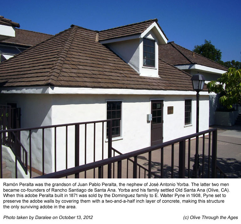
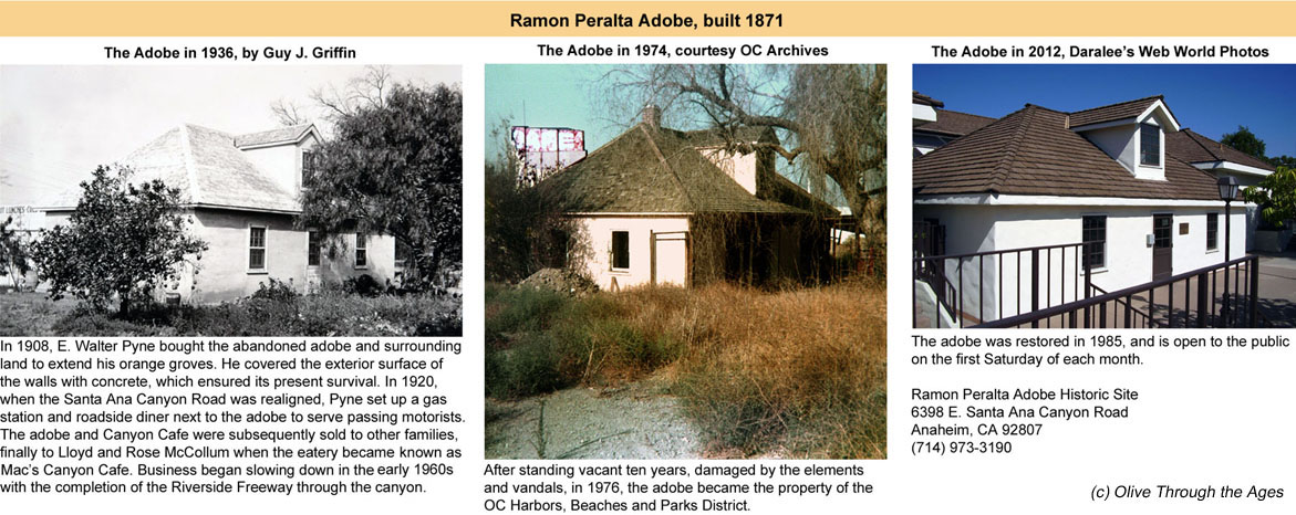
The Ramón Peralta adobe [see various images
at right from 1936, 1974, and 2012] is the only surviving adobe
in the area. When Ramón Peralta died in 1873, the adobe
was acquired by his cousin Pablo Dominguez. In 1881, after repairs
and remodeling to the structure, Dominguez and his bride Felipa
Yorba moved into the adobe. Following Dominguez's death in 1895,
the family moved to the north side of the Santa Ana River. (Source:
LA Times, November 26, 1988.)
The abandoned adobe and surrounding land were sold
to E. Walter Pyne in 1908 so he could extend his orange groves.
Pyne preserved the adobe walls by covering them with a two-and-a-half
inch layer of concrete.
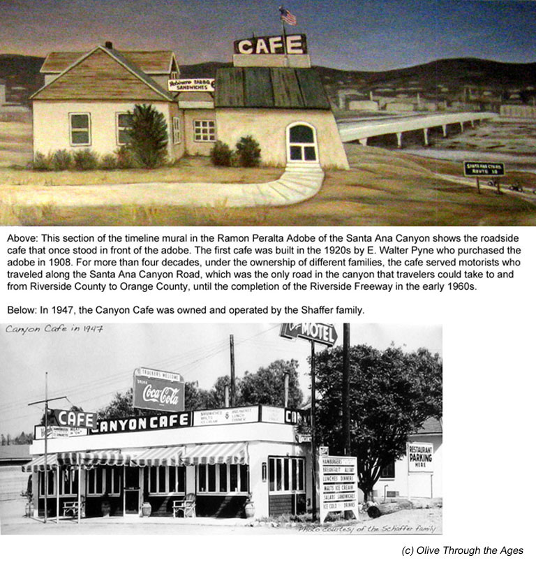
In 1920, when the Santa Ana Canyon Road was realigned,
Pyne set up a gas station and roadside diner next to the adobe
to serve passing motorists [see mural illustration at right].
The cafe operated for more than four decades under the ownership
of different families, such as the Shaffer family in 1947 [see
black and white image at right], and the McCollum family in the
early 1960s who named their eatery Mac's Canyon Cafe.
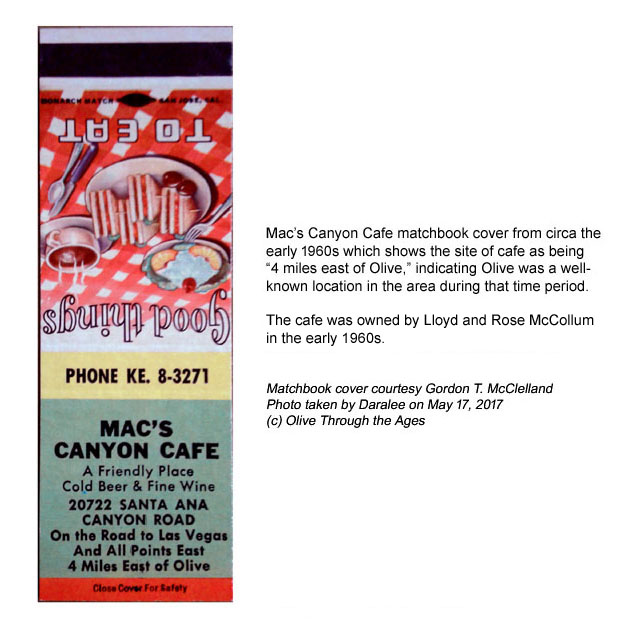
The Mac's Canyon Cafe matchbook cover from circa
the early 1960s [pictured right] shows the address of the diner
as 20722 Santa Ana Canyon Road, "4 Miles East of Olive,"
indicating that Olive was a well-known town by many locals during
that time. |
|
|
| |
|
|
 Yorba
Cemetery: In 1858, Don Bernardo Yorba set aside land as a cemetery
in Rancho Cañón de Santa Ana (Santa Ana Canyon) which
is known today as the Yorba Cemetery
[see 2007 image at right]. The cemetery is located in the Woodgate
Community in Yorba Linda, CA. Yorba
Cemetery: In 1858, Don Bernardo Yorba set aside land as a cemetery
in Rancho Cañón de Santa Ana (Santa Ana Canyon) which
is known today as the Yorba Cemetery
[see 2007 image at right]. The cemetery is located in the Woodgate
Community in Yorba Linda, CA. |
|
 |
| |
|
|
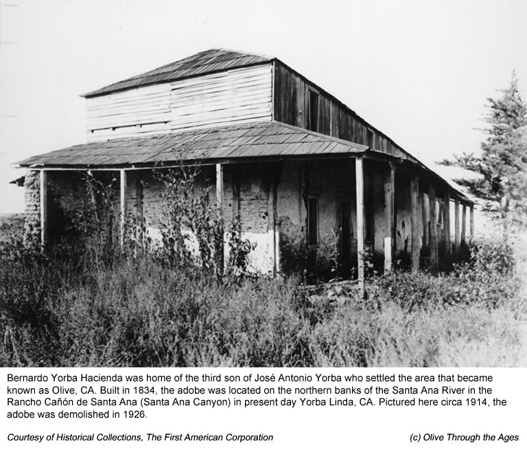
 Bernardo
Yorba Hacienda: Don Bernardo Yorba's hacienda, built in 1834
[see bottom right image from circa 1914], was located on the northern
banks of the Santa Ana River in Rancho Cañón de
Santa Ana (Santa Ana Canyon) in present day Yorba Linda, CA. The
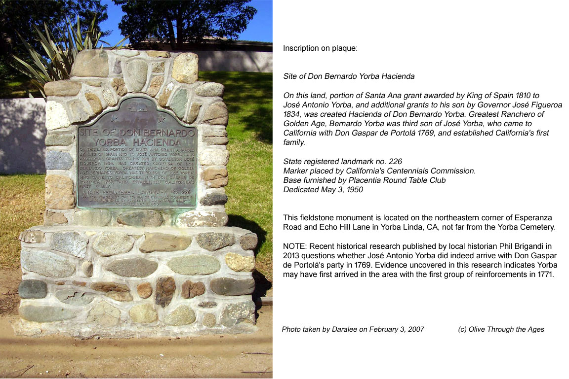
plaque on the fieldstone monument [see top right image from 2007]
reads: Bernardo
Yorba Hacienda: Don Bernardo Yorba's hacienda, built in 1834
[see bottom right image from circa 1914], was located on the northern
banks of the Santa Ana River in Rancho Cañón de
Santa Ana (Santa Ana Canyon) in present day Yorba Linda, CA. The
plaque on the fieldstone monument [see top right image from 2007]
reads:
Site of Don Bernardo Yorba Hacienda
On this land, portion of Santa Ana grant awarded by King of
Spain 1810 to José Antonio Yorba, and additional grants
to son by Governor José Figueroa 1834, was created Hacienda
of Don Bernardo Yorba. Greatest Ranchero of Golden Age, Bernardo
Yorba was third son of José Yorba, who came to California
with Don Gaspár de Portolá 1769, and established
California's first family.
State registered landmark no. 226 / Marker placed by California's
Centennials Commission. / Base furnished by Placentia Round Table
Club / Dedicated May 3, 1950
|
|
|
| |
|
|
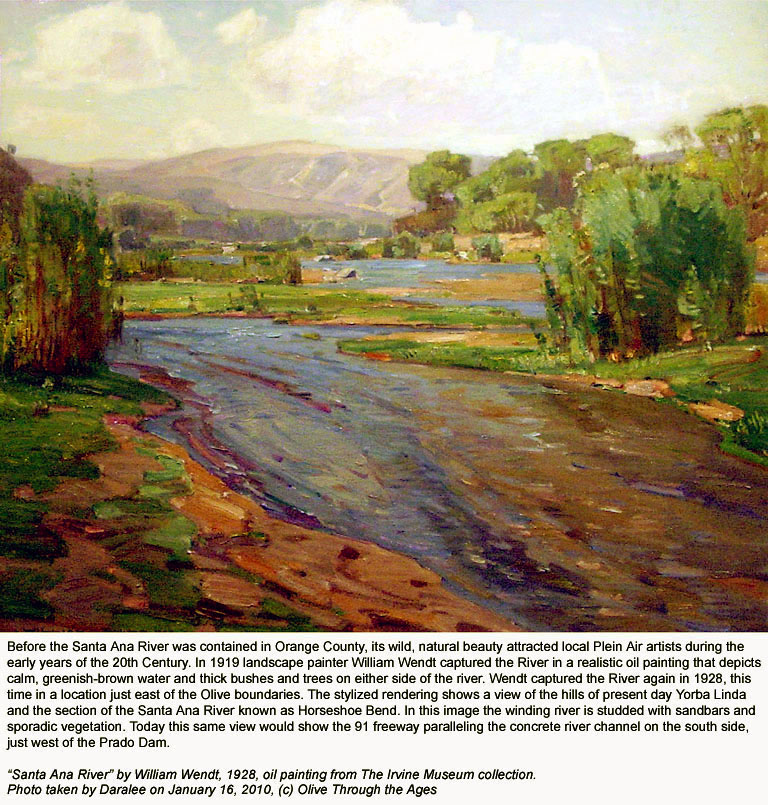
 Santa
Ana River near Olive: This 1928 oil painting by William Wendt
[pictured right] shows the section of the Santa Ana River near Horse
Shoe Bend, a few miles east of the Olive boundary at the time the
work was created. The basically naturalistic rendering gives the
viewer an idea of the vegetation, terrain, and how the river looked
before it largely became contained in its present concrete channel. Santa
Ana River near Olive: This 1928 oil painting by William Wendt
[pictured right] shows the section of the Santa Ana River near Horse
Shoe Bend, a few miles east of the Olive boundary at the time the
work was created. The basically naturalistic rendering gives the
viewer an idea of the vegetation, terrain, and how the river looked
before it largely became contained in its present concrete channel.
|
|
 |
| |
|
|
_______________________________________________
Top of page |
Tour index
_______________________________________________
|


