| Olive
Through the Ages
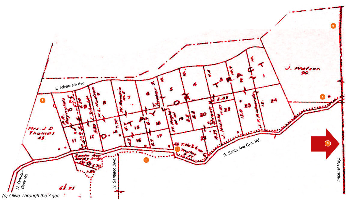
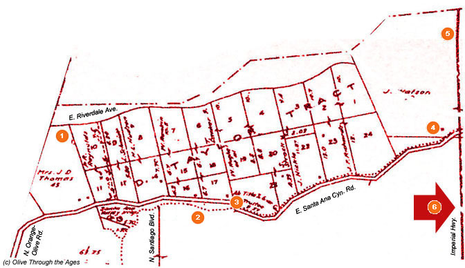
Click/tap the map below to view it larger. Click/tap the
link (A-K) to go to that section: Main,
A,
C, D,
E, F,
G, H,
I, J,
K
Click/tap the arrow labeled "6" on the map below
to go the extended Section B page for Santa
Ana Canyon.
_____________________________________________________________________________
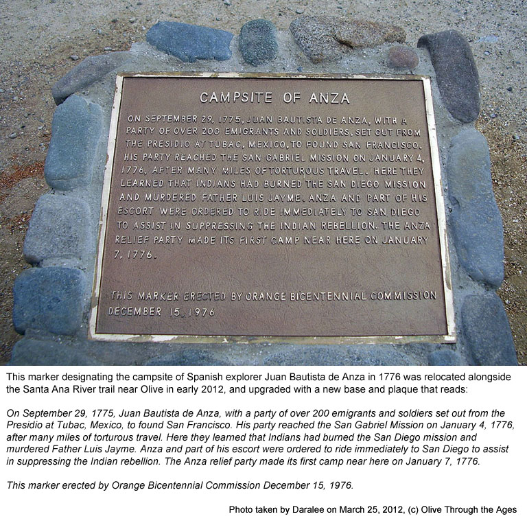
 Campsite
of Anza marker: The plaque tells of Juan Bautista de Anza and
his party's campsite in this general location on January 7, 1776,
en route to San Diego [see 2012 image at right]. The marker, located
on the Santa Ana River trail along East Riverdale Avenue near Orange-Olive
Road, was remade from the original one that was installed in 1976
on Riverdale, at the point where Orange-Olive Road ends. Campsite
of Anza marker: The plaque tells of Juan Bautista de Anza and
his party's campsite in this general location on January 7, 1776,
en route to San Diego [see 2012 image at right]. The marker, located
on the Santa Ana River trail along East Riverdale Avenue near Orange-Olive
Road, was remade from the original one that was installed in 1976
on Riverdale, at the point where Orange-Olive Road ends. |
|
 |
| |
|
|
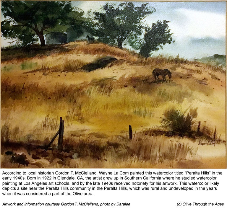
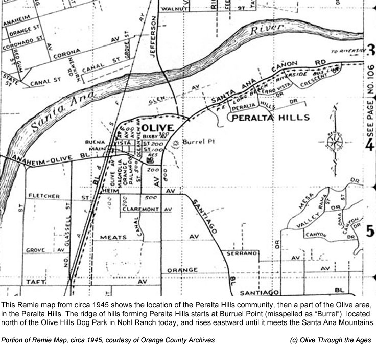
|  Peralta
Hills: According to historian Gordon T. McClelland, reknowned
artist Wayne La Com painted the watercolor, "Peralta Hills,"
[at right] in the early 1940s. The site of this painting was likely
near the Peralta Hills community today on land that was once a
part of Olive, CA. Peralta
Hills: According to historian Gordon T. McClelland, reknowned
artist Wayne La Com painted the watercolor, "Peralta Hills,"
[at right] in the early 1940s. The site of this painting was likely
near the Peralta Hills community today on land that was once a
part of Olive, CA.
At the time of this painting, the Peralta Hills
Estates was not yet formed. From the 1920s through 1950s, the
area was mostly rural.
The Peralta Hills community, located off E. Santa
Ana Canyon Rd. where it meets N. Santiago Blvd. at S. Lakeview
Blvd., is identified on the Remie Map from circa 1945 [at right].
The community is located on the Peralta Hills ridge of hills which
geographically begins at Burruel Point (near the Olive Hills Dog
Park today in the Nohl Ranch area), and extends eastward to the
Santa Ana Mountains.
|
|
|
| |
|
|
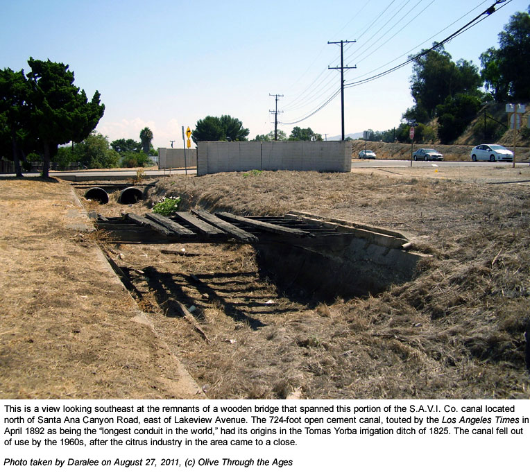
|  S.A.V.I.
Co. Canal: Remnants of the Santa Ana Valley Irrigation Company
canal from the 1890s and wooden bridges that spanned the canal
can still be found alongside the Santa Ana Canyon Road in present
day Anaheim Hills, CA [see 2011 image at right]. The canal had
its origins in the Tomás Yorba irrigation ditch of 1825
which started from the Santa Ana River, west of present day Imperial
Highway on land that was once a part of Olive, CA. S.A.V.I.
Co. Canal: Remnants of the Santa Ana Valley Irrigation Company
canal from the 1890s and wooden bridges that spanned the canal
can still be found alongside the Santa Ana Canyon Road in present
day Anaheim Hills, CA [see 2011 image at right]. The canal had
its origins in the Tomás Yorba irrigation ditch of 1825
which started from the Santa Ana River, west of present day Imperial
Highway on land that was once a part of Olive, CA.
|
|
 |
| |
|
|
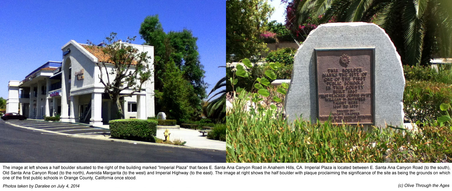
 Marker
for one of the first public schools in Orange County, CA:
One of the first public schools in Orange County, CA was built
in 1867 on the north side of present day Santa Ana Canyon Road,
west of Imperial Highway
[see 2014 image at right designating the site of this historical
structure]. From the early 1900s up to the 1950s, the site on
which the school was built was regarded as being a part of Olive. Marker
for one of the first public schools in Orange County, CA:
One of the first public schools in Orange County, CA was built
in 1867 on the north side of present day Santa Ana Canyon Road,
west of Imperial Highway
[see 2014 image at right designating the site of this historical
structure]. From the early 1900s up to the 1950s, the site on
which the school was built was regarded as being a part of Olive.
|
|
 |
| |
|
|
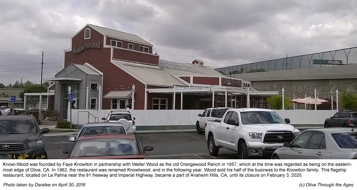
 Knowlwood
Restaurant: This original restaurant in the family-owned chain
was named Orangewood Ranch when it was founded in 1957 by Faye Knowlton
and Walter Wood. The name changed to Knowlwood in 1962, and in the
following year Wood sold his half of the business to the Knowlton
family. (Source: Orange County Register, October 19, 2014.) In its
early years, the site of this restaurant on La Palma Avenue in Anaheim
Hills, CA [see 2016 image at right] marked the eastern-most edge
of the town of Olive, just west of Imperial Highway. Knowlwood
Restaurant: This original restaurant in the family-owned chain
was named Orangewood Ranch when it was founded in 1957 by Faye Knowlton
and Walter Wood. The name changed to Knowlwood in 1962, and in the
following year Wood sold his half of the business to the Knowlton
family. (Source: Orange County Register, October 19, 2014.) In its
early years, the site of this restaurant on La Palma Avenue in Anaheim
Hills, CA [see 2016 image at right] marked the eastern-most edge
of the town of Olive, just west of Imperial Highway. |
|
 |
| |
|
|
 Extended
Map of Santa Ana Canyon near Olive: This portion of a 1916
road map includes sites relevant to Olive and this website: Ramon
Peralta Adobe built in 1871 which became Mac's Canyon Cafe in
the 1950s; Historic Yorba Cemetery; Bernardo Yorba Hacienda marker;
and section of the Santa Ana River near Horse Shoe Bend where
William Wendt created his "Santa Ana River" oil painting
in 1928. Extended
Map of Santa Ana Canyon near Olive: This portion of a 1916
road map includes sites relevant to Olive and this website: Ramon
Peralta Adobe built in 1871 which became Mac's Canyon Cafe in
the 1950s; Historic Yorba Cemetery; Bernardo Yorba Hacienda marker;
and section of the Santa Ana River near Horse Shoe Bend where
William Wendt created his "Santa Ana River" oil painting
in 1928.
|
|
 |
| |
|
|
_______________________________________________
Top of page |
Tour index | Previous
| Next
_______________________________________________
|